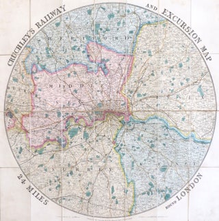
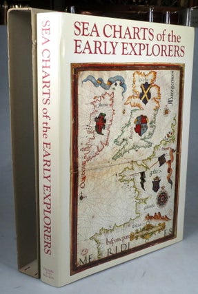
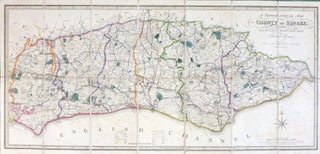
Cruchley's Railway and Excursion Map 24 Miles Round London.
London: Cruchley, 1857. Map diameter 63 cm, overall 66 x 66.5 cm. Circular folding map of the environs of London extending from Ware down to Dorking and Stanford-le-Hope across to Windsor, full original colour marking out the counties, dissected into 28 sections and mounted on linen, marbled paper to the..... More
![Item #27834 [Map of Paris]. Département de la Seine. Pierre DUMEZ](https://bowwindows.cdn.bibliopolis.com/pictures/27834.jpg?width=320&height=427&fit=bounds&auto=webp&v=1474895785)

![Item #46814 [Geological Map of Sussex and part of Hampshire]. Geological Survey of Great Britain,...](https://bowwindows.cdn.bibliopolis.com/pictures/46814.jpg?width=320&height=427&fit=bounds&auto=webp&v=1712743352)
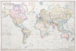
![Item #23087 [Collection of Six Folding Maps]: The World on Mercator's Projection. [with] Map...](https://bowwindows.cdn.bibliopolis.com/pictures/23087.jpg?width=320&height=427&fit=bounds&auto=webp&v=1446578509)
![Item #37218 The American Atlas 1776. [Second title, copying the original] The American Atlas: or,...](https://bowwindows.cdn.bibliopolis.com/pictures/37218.jpg?width=320&height=427&fit=bounds&auto=webp&v=1608035893)
![Item #40198 New Dissected Map of England [and Wales]. JIGSAW](https://bowwindows.cdn.bibliopolis.com/pictures/40198.jpg?width=320&height=427&fit=bounds&auto=webp&v=1645108769)
![Item #28582 Johnstons' Atlas of the War 1855. [Comprising]: Johnston's New Map of the Seat of War...](https://bowwindows.cdn.bibliopolis.com/pictures/28582.jpg?width=320&height=427&fit=bounds&auto=webp&v=1485869247)