![Item #40198 New Dissected Map of England [and Wales]. JIGSAW.](https://bowwindows.cdn.bibliopolis.com/pictures/40198.jpg?width=768&height=1000&fit=bounds&auto=webp&v=1645108769)
![New Dissected Map of England [and Wales].](https://bowwindows.cdn.bibliopolis.com/pictures/40198_2.jpg?auto=webp&v=1645108769)
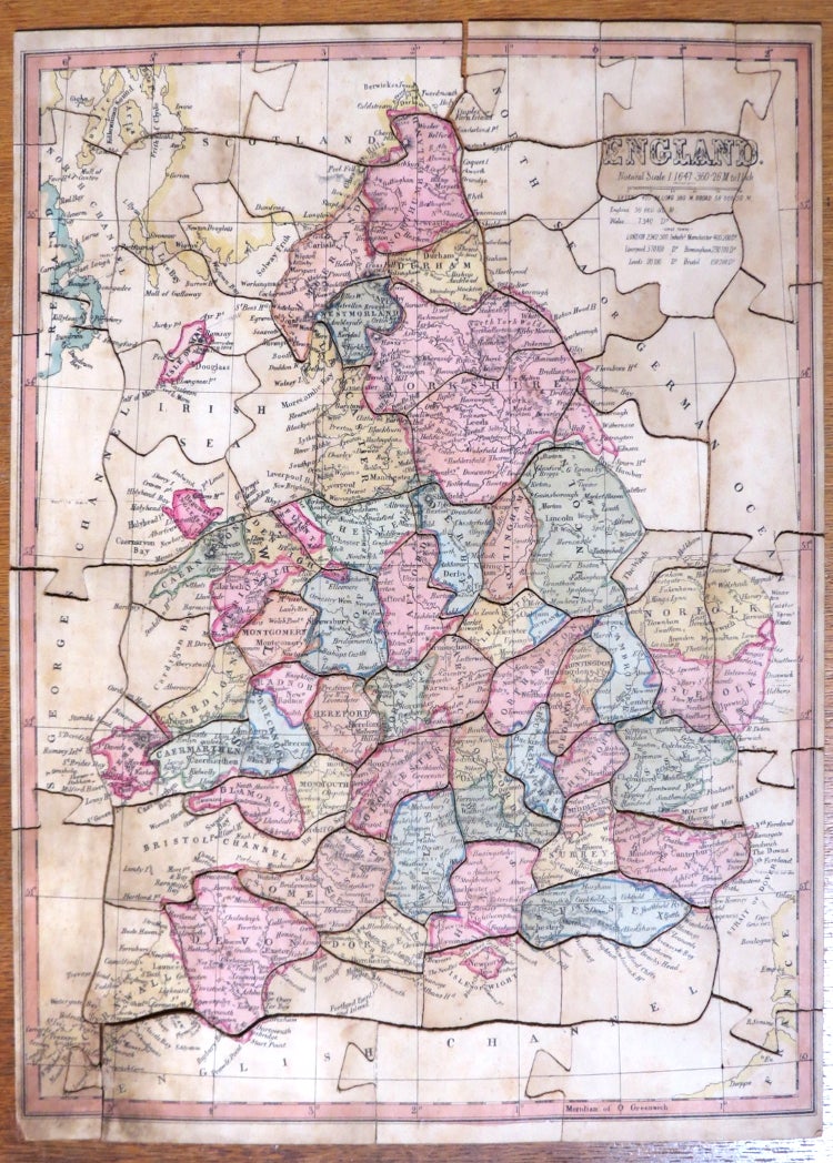
New Dissected Map of England [and Wales].
[n.p., 1840s]. A mid-19th century map of England and Wales, laid on wood and dissected generally along county borders. Complete, with the border pieces interlocking - two of the tabs broken but present. Some soiling and light warping of the wood, held in the original wooden box with a sliding decorative lid. The price includes VAT in the UK. Item #40198
Price: £480.00
See all items in
Maps & Atlases
See all items by JIGSAW