![Item #27834 [Map of Paris]. Département de la Seine. Pierre DUMEZ.](https://bowwindows.cdn.bibliopolis.com/pictures/27834.jpg?width=768&height=1000&fit=bounds&auto=webp&v=1474895785)
![[Map of Paris]. Département de la Seine.](https://bowwindows.cdn.bibliopolis.com/pictures/27834_2.jpg?auto=webp&v=1474895785)
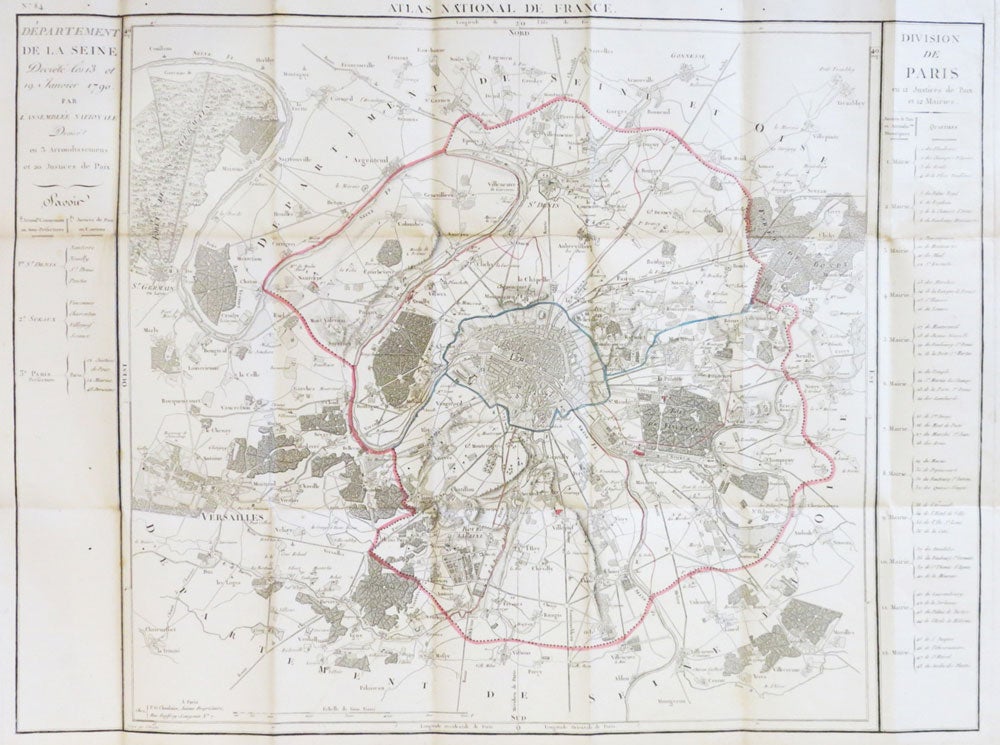
[Map of Paris]. Département de la Seine.
Paris: P.G. Chanlaire, [1790]. Engraved folding map, dimensions 47 x 50 cm, overall 54 x 80 cm. Hand coloured in outline, with columns either side showing the arrondissements and Justices of the Peace. Some mild foxing and browning, mostly marginal. Contemporary marbled paper case, folding flap still with its wraparound tie, some wear to extremities. Map no. 84 in Chanlaire's "Atlas National de France" Item #27834
Price: £250.00
See all items in
Maps & Atlases
See all items by Pierre DUMEZ