![Item #23087 [Collection of Six Folding Maps]: The World on Mercator's Projection. [with] Map Exhibiting the Navigable Rivers, the Completed & Proposed Rail-Roads of Great Britain & Ireland, with the Coal Fields, Light House &c. [with] Central & Southern Europe with the Mediterranean Sea. [with] British Possessions in North America, with Part of the United States, Compiled from Official Sources. [with] Central America and the West Indies... [and] Asia. S. HALL, J. WALKER.](https://bowwindows.cdn.bibliopolis.com/pictures/23087.jpg?width=768&height=1000&fit=bounds&auto=webp&v=1446578509)
![[Collection of Six Folding Maps]: The World on Mercator's Projection. [with] Map Exhibiting the Navigable Rivers, the Completed & Proposed Rail-Roads of Great Britain & Ireland, with the Coal Fields, Light House &c. [with] Central & Southern Europe with the Mediterranean Sea. [with] British Possessions in North America, with Part of the United States, Compiled from Official Sources. [with] Central America and the West Indies... [and] Asia.](https://bowwindows.cdn.bibliopolis.com/pictures/23087_2.jpg?auto=webp&v=1446578509)
![[Collection of Six Folding Maps]: The World on Mercator's Projection. [with] Map Exhibiting the Navigable Rivers, the Completed & Proposed Rail-Roads of Great Britain & Ireland, with the Coal Fields, Light House &c. [with] Central & Southern Europe with the Mediterranean Sea. [with] British Possessions in North America, with Part of the United States, Compiled from Official Sources. [with] Central America and the West Indies... [and] Asia.](https://bowwindows.cdn.bibliopolis.com/pictures/23087_3.jpg?auto=webp&v=1446578509)
![[Collection of Six Folding Maps]: The World on Mercator's Projection. [with] Map Exhibiting the Navigable Rivers, the Completed & Proposed Rail-Roads of Great Britain & Ireland, with the Coal Fields, Light House &c. [with] Central & Southern Europe with the Mediterranean Sea. [with] British Possessions in North America, with Part of the United States, Compiled from Official Sources. [with] Central America and the West Indies... [and] Asia.](https://bowwindows.cdn.bibliopolis.com/pictures/23087_4.jpg?auto=webp&v=1446578509)
[Collection of Six Folding Maps]: The World on Mercator's Projection. [with] Map Exhibiting the Navigable Rivers, the Completed & Proposed Rail-Roads of Great Britain & Ireland, with the Coal Fields, Light House &c. [with] Central & Southern Europe with the Mediterranean Sea. [with] British Possessions in North America, with Part of the United States, Compiled from Official Sources. [with] Central America and the West Indies... [and] Asia.
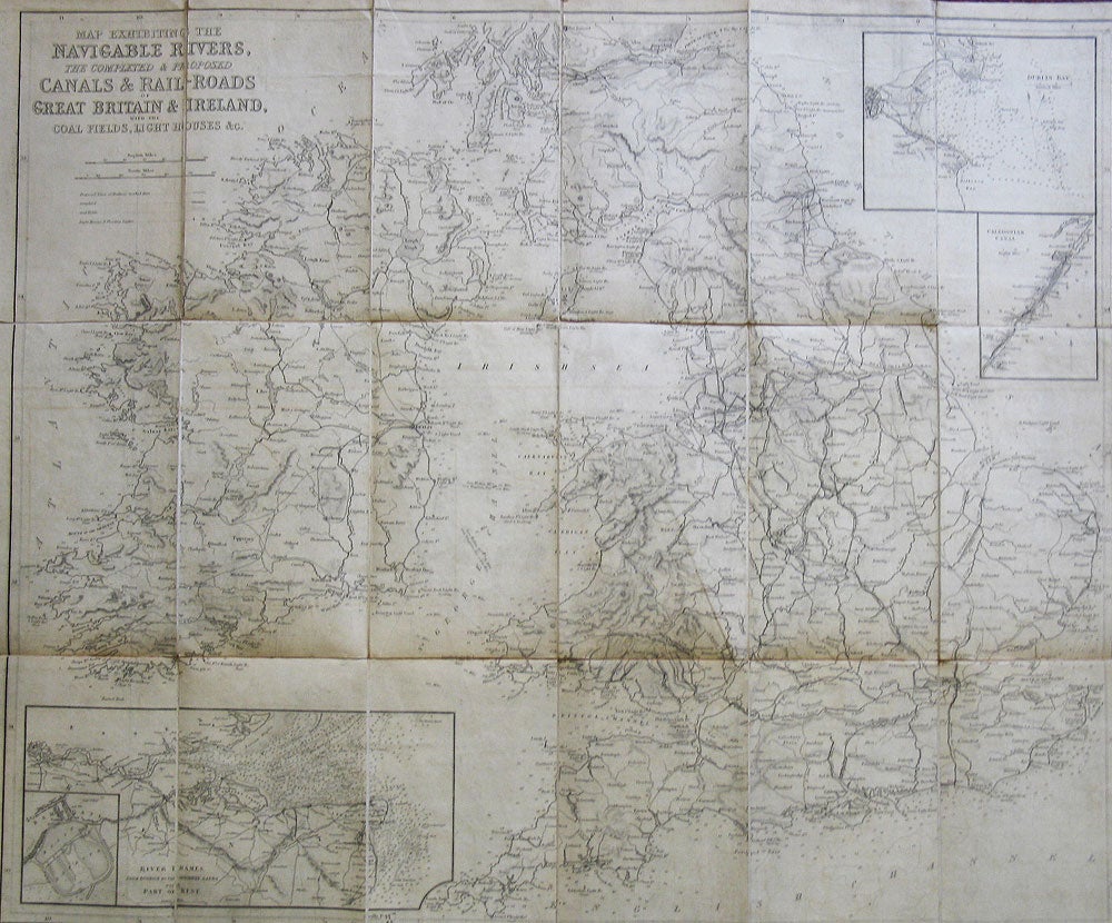
London: Longman & Co., 1840-41. Six folding maps of various sizes between 52 x 63 cm and 38 x 46 cm, all dissected and mounted on linen, the map of Asia with original outline colour, others uncoloured, matching patterned papers to the folded end sections and with handwritten title labels to one side, all folding down to a uniform size and housed in a contemporary plain green cloth slipcase. A very good set. The map of Asia by John Walker, the others by Hall. The former features regional inset maps: the World - Canton, Tasmania, the River Hooghly, Singapore, Cape of Good Hope; the British Isles - the River Thames, Dublin Bay, the Caledonian Canal; Europe - the River Schelde, Odessa, Valetta; North America - Montreal, Quebec, Newfoundland; Central America and West Indies: Port Royal & Kingston, Jamaica, Havana. Item #23087
Price: £400.00