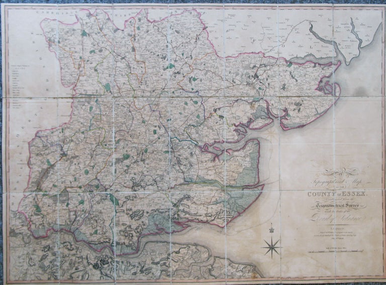
A Topographical Map of the County of Essex. Constructed from the Trigonometrical Survey Made by Order of the Board of Ordnance.
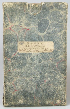
London: W. Faden, July 6th, 1804. Map dimensions 63 x 87 cm, overall 64.5 x 88 cm. An attractive folding map of the county with original colour in block and outline. Scale: ½ inch to one mile. Dissected into 21 sections and mounted on linen, both folded end sections with marbled paper tabs, one side with a publisher's label, folds into original marbled paper slipcase with printed label to upper cover. Some wear to the case with the upper edge of one joint cracked, the map slightly browned overall, otherwise a very good copy. Essex was the second Ordnance Survey map to be published, preceded by Kent in 1801. This is the true first edition of their map of the county, the full four sheet version being published the following year. Rare, the only institutional copies found are in the British Library, Cambridge and Oxford. The only auction record is the Wardington copy, sold at Sotheby's in 2006. Item #20435
Price: £320.00