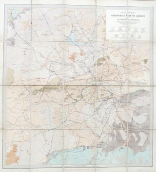
Stanford's Geological Map of London Shewing Superficial Deposits. Compiled by... Assistant Keeper of Mining Records from the Geological Survey Maps of the District. Surveyed Principally W. Whitaker...
London: Edward Stanford, 1902. Third edition. Map dimensions 62 x 57 cm, overall 67 x 62 cm. Folding geologically coloured map showing the extents from Watford down to Epsom and Barking across to Southall, dissected into 20 sections and mounted on linen, folds between original blindstamped green cloth covers, gilt..... More