![Item #35626 [Ordance Survey Map of East Hampshire, West Sussex and South-West Surrey]. SUSSEX.](https://bowwindows.cdn.bibliopolis.com/pictures/35626.jpg?width=768&height=1000&fit=bounds&auto=webp&v=1580822761)
![[Ordance Survey Map of East Hampshire, West Sussex and South-West Surrey].](https://bowwindows.cdn.bibliopolis.com/pictures/35626_2.jpg?auto=webp&v=1580822761)
[Ordance Survey Map of East Hampshire, West Sussex and South-West Surrey].
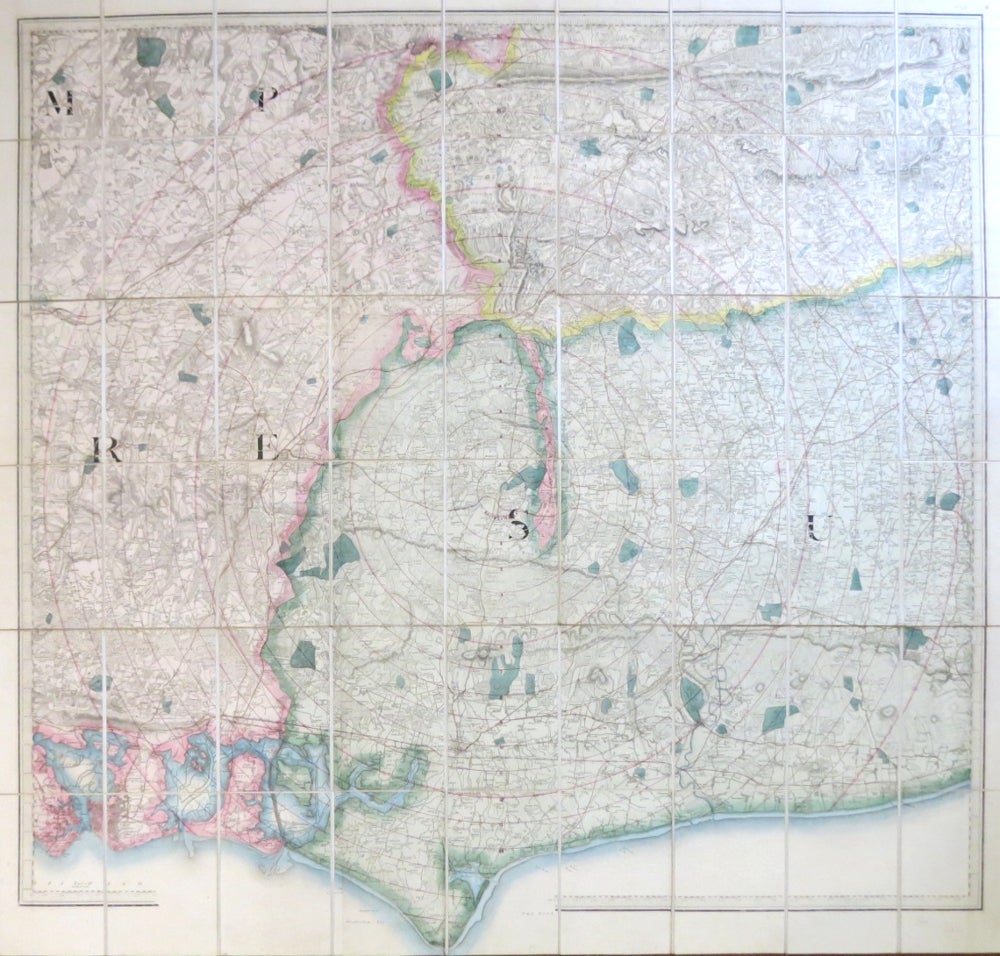
(London: Edward Stanford, [c.1840]. Folding map on linen with dissections, 88.5 x 97 cm, overall dimensions 100 x 106 cm, to a scale of 1 mile to the inch, from Portsmouth in the east to Worthing in the west and going as far inland as Guildford, the map extending through the border to allow for Selsey Bill. Hand coloured in outline with Sussex coloured in a light green. A series of concentric red ink circles has been drawn on the map, centered on Midhurst, extending out to the edges of the map. Original red cloth case with a printed Stanford's label, marked "Midhurst" with a further label marked thus to the spine. An unusual example. The map has two armorial blind stamps to the upper margin dated 1867, although since no railway stations are shown it must be dated much earlier. Item #35626
Price: £100.00