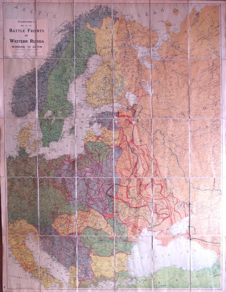
Stanford's Map of the Battle Fronts of Western Russia. Murmansk to Batum.
London: Edward Stanford, [early 1940s]. Map dimensions 110.5 x 84.5 cm, overall 113.5 x 88.5 cm. Large folding colour printed map of the region extending from Finnmark down to the Aegean and Württemberg across to Stalingrad, copiously annotated with red and dark blue pencilled lines in an old hand principally in the Russian theatre but also across eastern Europe, dissected into thirty sections and mounted on linen, brown cloth panels to the folded end sections with a Sifton Praed label to one side. The paper fairly evenly tanned overall, some pinholes to the corners from previous use, a decent example. OCLC lists several issues between 1941 and 1945. Item #34979
Price: £200.00