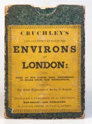
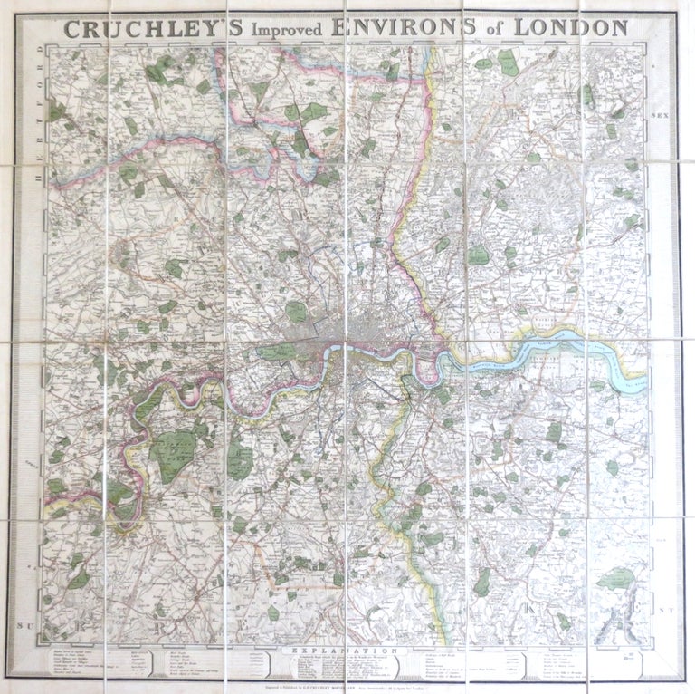
Cruchley's Improved Environs of London.
London: G.F. Cruchley, [c.1830]. Map dimensions 57 x 58 cm, overall 60.5 x 61.5 cm. Decorative folding map of London showing the extents from Cheshunt down to Banstead and Ranham across to Southall, original colour marking out the county boundaries, principal roads, parks and bodies of water, border mounted to the edges of the map incorporating the title to the upper edge and the "explanation" to the lower. Dissected into 24 sections and mounted on linen, green marbled paper to the folded end sections with an advertisement to one side, matching marbled papered slipcase with yellow publisher's printed label to the upper cover. The slipcase somewhat worn to the edges but sound, a very good example of an attractive map. Akin to Howgego, no. 325a, (1) but cf. 299 also. Featuring the Surrey Iron Railway and St Katherine's Dock, the map almost certainly dates from 1830. Howgego reports of a similar version of map in a private collection with a mounted border as here, being a cut down version of the larger "Cruchley's Environs of London Extending Thirty Miles from the Metropolis" (no. 299). In all other regard, it conforms to the first state of no. 325a. Item #34256
Price: £675.00