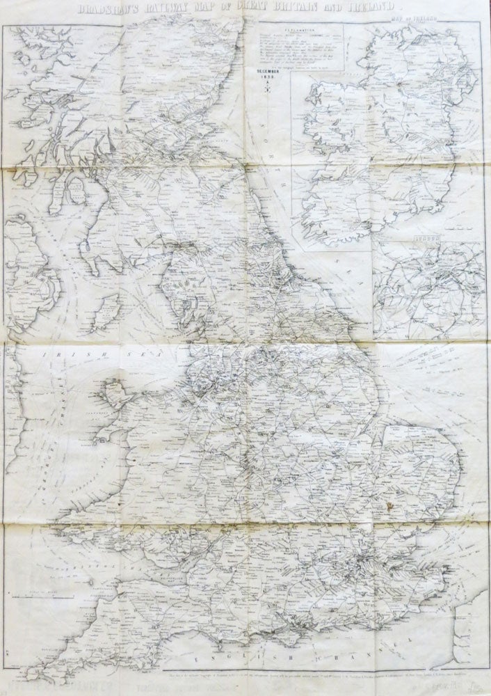
Bradshaw's Railway Map of Great Britain and Ireland.
London and Manchester: Bradshaw and Blacklock, Lithographers, December, 1859. Map dimensions 57.5 x 43 cm, overall 62.5 x 44.5 cm. Folding railway map of England Wales and southern Scotland with a large inset map of Ireland to the upper right corner and a smaller inset of London, not dissected and printed on thin paper, backed with japan paper, much of the printed text on the verso (advertisements and directions to travellers) still legible, though some of the smaller text has been obscured, later brown cloth chemise and matching slipcase, but still of some age. A decent, well preserved copy of a fragile item. Uncommon. Item #25667
Price: £250.00
See all items in
Maps & Atlases