
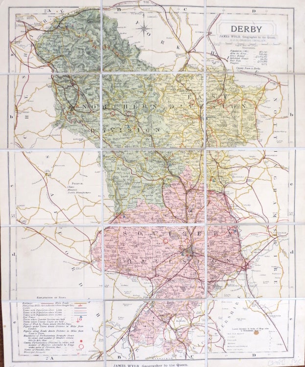
Derby.
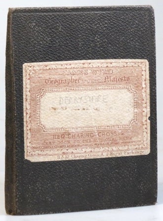
London: James Wyld, [1880s]. Map dimensions 41.5 x 33 cm, overall 43 x 35 cm. Folding map of Derbyshire with original colour demarcating the county into northern, eastern and southern divisions, dissected into 15 sections and mounted on linen, folds between original brown cloth covers with publisher's printed label to the upper cover, publisher's printed advertisements to the inner cover and the folded end section, the former surmounted with the contemporary armorial bookplate of a William Alfred Gibbs. Some light rubbing to the covers, small brown spot to the lower right corner of the map, very good overall. A statistical table to the upper right corner refers to the county's population in the 1881 census (461,141). Other statistics provided include the Poor Rate (£170,882) and the number of paupers (9,775). Item #31963
Price: £35.00