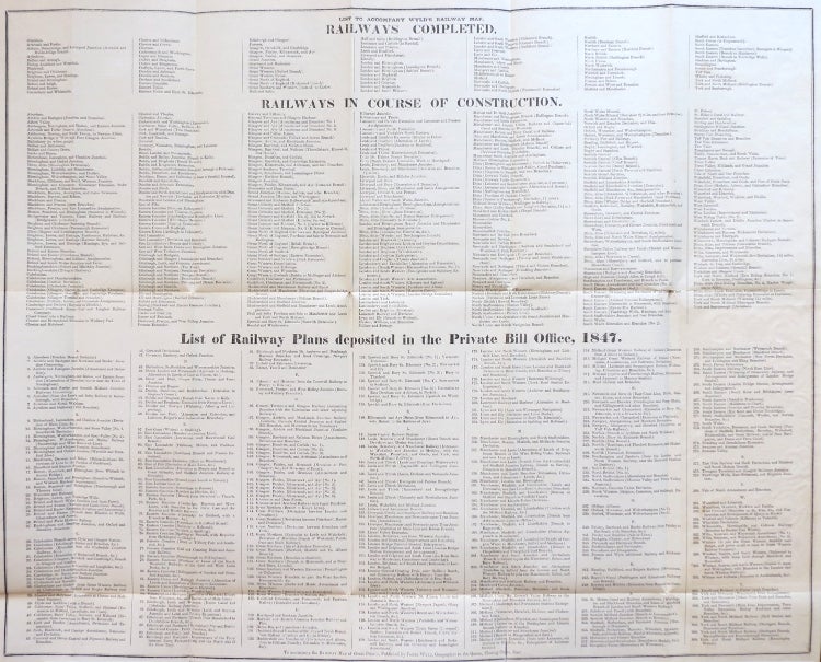
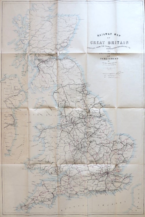
Railway Map of Great Britain Compiled from the Plans Deposited According to the Standing Orders of Parliament.
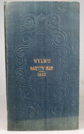
London: James Wyld, 1847. Map dimensions 83 x 55 cm, overall 85 x 57 cm. Folding map illustrating the railways with the routes highlighted in original colour variously according to whether they were completed, in progress or at that stage merely proposed, with a corresponding printed list of the railways grouped by their stage of development on a printed sheet measuring 48 x 60 cm overall, both parts folding between publisher's blindstamped blue cloth boards, gilt lettered to the upper cover. Neither sheet dissected and/or mounted on linen, thus fragile, however they remain in remarkably good condition with just a few very minor splits at folds, these with subtle tissue repairs, the covers in excellent condition. Uncommon, Copac presents four different editions of the map published between 1845 and 1860 and just one from this year. Item #29048
Price: £200.00