![Item #28510 [Walworth]. London Sheet XI.15. ORDNANCE SURVEY.](https://bowwindows.cdn.bibliopolis.com/pictures/28510.jpg?width=768&height=1000&fit=bounds&auto=webp&v=1484062537)
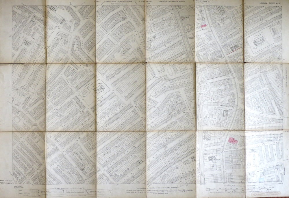
[Walworth]. London Sheet XI.15.
London: The Ordnance Survey, 1895. Map dimensions 94 x 61 cm, overall 102 x 70 cm. Some mostly pencilled annotation with two locations hand coloured, browning to the edges of each section, end of a few folds slightly torn, Stanford label to the lower margin, with one cloth and one marbled paper end section once folded, some mostly light rubbing. Showing the now defunct Walworth Road station and from Doddington Grove in the north-west to Boundary Lane in the south-east. Item #28510
Price: £60.00
See all items in
Maps & Atlases
See all items by ORDNANCE SURVEY