![Item #28506 [Bermondsey]. London Sheet XI.18. ORDNANCE SURVEY.](https://bowwindows.cdn.bibliopolis.com/pictures/28506.jpg?width=768&height=1000&fit=bounds&auto=webp&v=1484062537)
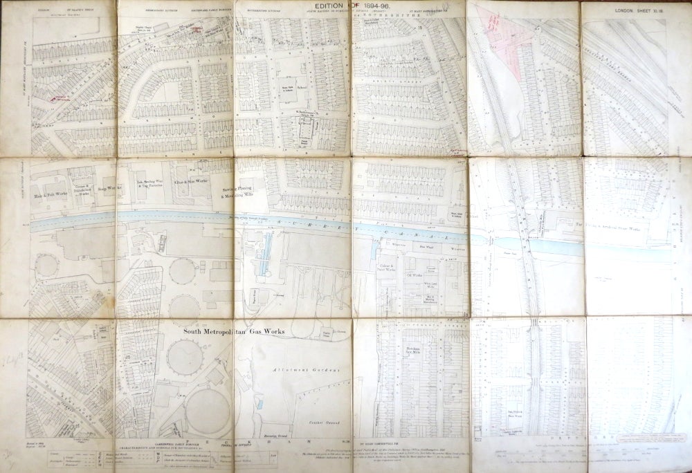
[Bermondsey]. London Sheet XI.18.
London: The Ordnance Survey, 1895. Map dimensions 94 x 61 cm, overall 102 x 70 cm. The Surrey canal is hand coloured in blue and a small area to the top of the map is coloured pink and annotated, there are several other annotations in both ink and pencil, Stanford label to the lower margin, light browning to the edge of each section. Backed onto linen and dissected, with three folds partly torn, with one cloth and one marbled paper end section once folded, some general rubbing and wear. The map shows an area in south Bermondsey from Delaford Road in the north to Sharratt Street in the south, and from Rotherhithe New Road in the west to Stockholm Road in the west. The area where the New Den is now is just shown to the top right of the map. Item #28506
Price: £60.00