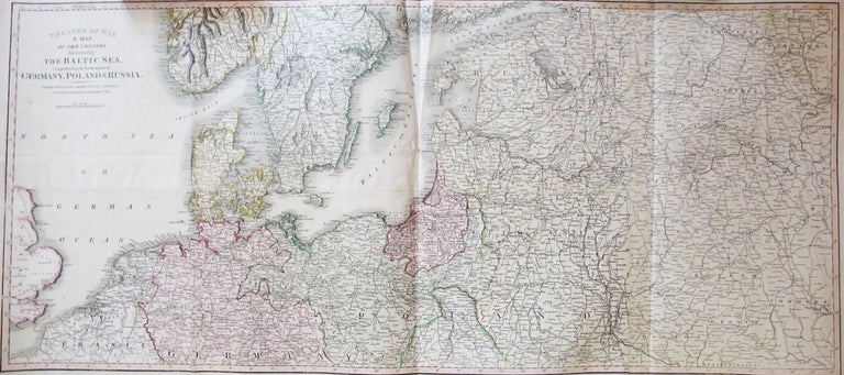
Theatre of War. A Map of the Country Surrounding the Baltic Sea, Comprehending the Northern Part of Germany, Poland & Russia,
London: C. Smith, June 4th, 1812. Dimensions 39 x 110.5 cm. Large copper engraved map of the theatre of the war in northern Europe, covering the extents from the North Sea across the Baltic region to Nizhny Novgorod in the east. Printed over four irregularly sized conjoined sheets folded twice, original hand colouring in block and outline. Three very short marginal tears, some minor creasing and a single, fairly inconspicuous hole to the centre of the map, else very good. A singly issued map of the region, published just a few weeks prior to Napoleon's invasion of Russia. Uncommon, Worldcat locates three copies: the British Library, Yale and Oklahoma. Item #22007
Price: £360.00