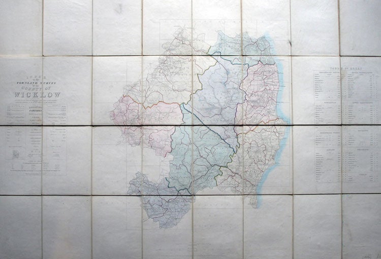
Index to the Townland Survey of the County of Wicklow.
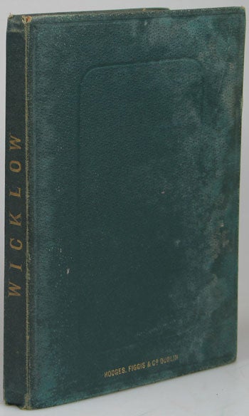
Dublin: Engraved at the Ordnance Survey Office, Phoenix Park, 1839. Overall dimensions 67 x 96 cm. Large folding map of County Wicklow, being an index map the county is shown divided into forty-seven numbered squares relating to larger scale map sheets issued by the Survey. The map with original hand colour in block and outline demarcating areas within the county. Title and explanatory key to the left edge, panel to the right outlining the areas previously mentioned and their parishes with their respective sizes. The whole dissected into thirty two sections and mounted on linen, folds between original dark green cloth covers, brief title in gilt to spine, mapsellers' names in gilt to upper board, marbled paper to inner cover and to folded end section on linen verso. Some discolouration to covers, but sound. A few light marks to the map, but essentially in very good condition. Beneath the explanatory key is a printed scale of prices noting that 12 of the map sheets were to be priced at 2 shillings each, the remainder 2/6. The map was drawn by Charles B. Cradock and John R. Clark and engraved by John Hacket and William B. Ryan. Item #19594
Price: £120.00