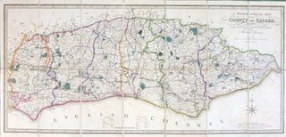
A Topographical Map of the County of Sussex; Reduced from the Large Survey in Four Sheets by...
London: James Wyld, 1844. Map dimensions 36.5 cm x 79.5, overall 40.5 x 83 cm. Folding map of the county with original colour in block and outline, marking out the county boundaries, rapes, principal roads, railways etc., dissected into 14 sections and mounted on linen, marbled paper to the folded..... More