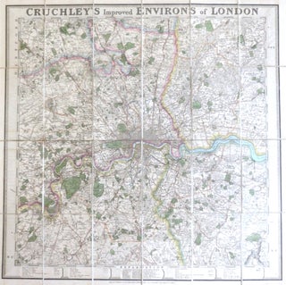
Cruchley's Improved Environs of London.
London: G.F. Cruchley, [c.1830]. Map dimensions 57 x 58 cm, overall 60.5 x 61.5 cm. Decorative folding map of London showing the extents from Cheshunt down to Banstead and Ranham across to Southall, original colour marking out the county boundaries, principal roads, parks and bodies of water, border mounted to..... More