Cruchley's Improved Geographical Companion Throughout England & Wales Including Part of Scotland.
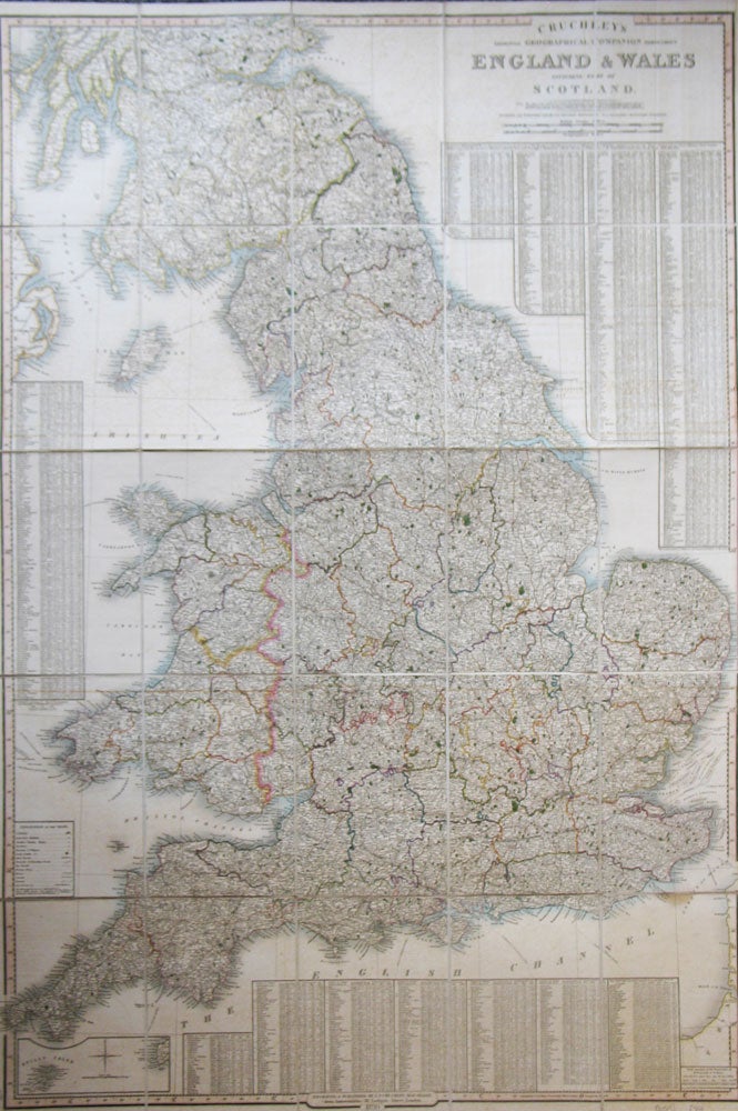
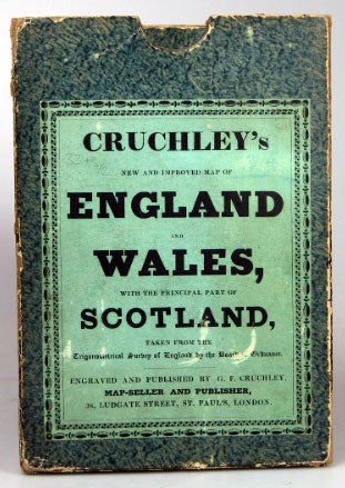
London: G.F. Cruchley, 1830. Map dimensions 96.5 65 cm, overall dimensions 99 x 67.54 cm. Large folding map of England and Wales, with original outline colour marking out the county boundaries. Very detailed tables to the left, lower and right edges listing towns and cities with their individual county names, market days, distances from London and populations in the census years 1801, 1811 and 1821. The whole dissected into 25 sections and mounted on linen, folding into the original green marbled slipcase with a publisher's label to the upper board, matching marbled paper to folded end sections on the linen verso. of map, one side with a publisher's advertisement. The slipcase slightly worn at the edges, though sound, some light offsetting to the map, a very good example overall. Item #20517
Price: £240.00